


A while back I wrote about the ongoing Highway 53 reroute affecting the Iron Range Quad Cities of Mt. Iron, Virginia, Eveleth and Gilbert, really the central artery of the region. The Laurentian Chamber of Commerce has a project home page with updates, including this map.
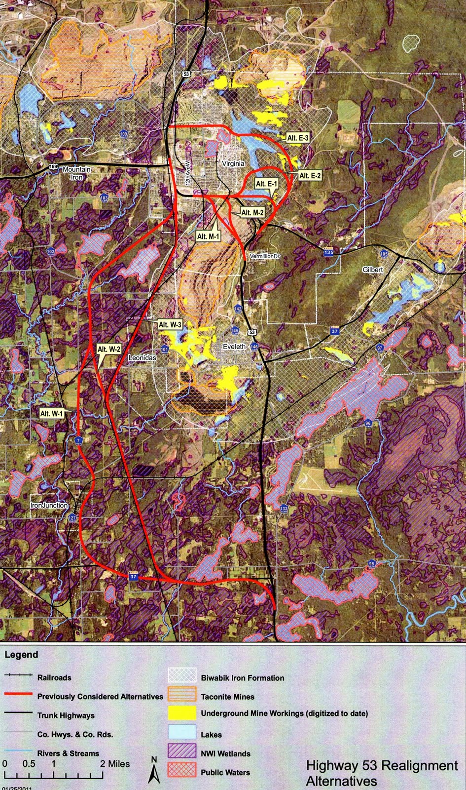
Eveleth is that gray blur in the center, Virginia located due north. Most of the plans that local business leaders like have the highway going over the iron formation (the current highway is being moved because it is on the iron formation). The routes that take the highway safely away from mining activity put it off into the Finnish farmlands of Iron Junction and West Eveleth, a serious change.
As I wrote in a column about this time last year, eventually we need to figure out the reality of our planning around here. If we’re counting on 100 years of mining-based employment, we should stop building $100 million highways over mining areas. Such an investment should accompany plans that could one day diversify our economy so that our highways may stay in place.
One response to “The Iron Range’s highway connundrum”
History repeats! At the turn of the 1900s, a whole town was moved because of iron…Hibbing.
I am sure there are more examples, as well.